
Please click on each image to enlarge and for prices
Antique Maps of the World & America 1690-1856 |
Please click on each image to enlarge
and for prices
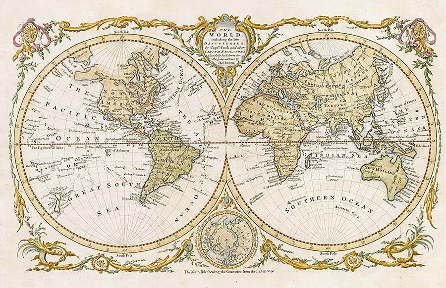 |
| Thos. Bowen, from GENTLEMAN'S MAGAZINE. LONDON,
The World, including the North Pole 1775,
Measures approximately 14 3/4 inches by 19 1/2, TW1 $550 |
 |
|
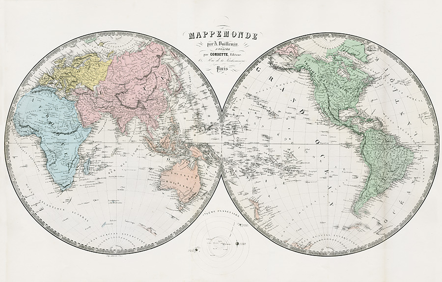
Map of the World by A.Vuillemin publisher Combatte, Paris circa 1845, Measures approximately 29 1/2 inches by 19 3/8 inches, LSR51 $39551 $395 |
 |
| Creation du Monde,
Six Days of Creation of Earth by Claude Buy de Mornas 1768 DEN3 $225 |
 |
|
Map of the World
Map of the World on Mercators Projection by Alex Findlay
1843 MAP3 $95 Measures approx 16 1/2 by 10 1/2 |
 |
|
Splendid map of the world on an oval projection showing California as an Island and partially mapped Australia and New Zealand. Measures approximately 16 x 10 3/4 inches Original Copper Plate Engraving 1702 with later color SCH1 $1,250 |
 |
| Bellin Copper Plate
Map of the Arctic, Asia, Pacific Northwest America Orginal Copper Plate Engraving 1758 BMI1 $595 |
 |
|
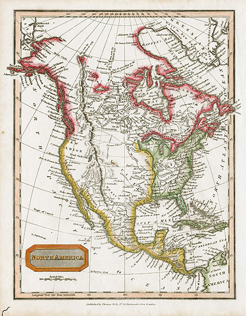
North America, Pre Louis & Clark, Very Early Place
Names including California as New Albion,
Western Mexico as Navarre Original hand colouring, Published by C. Smith, London 1808, Engraved by B. Smith, 11 1/2" x 15" TWI1 $395 |
 |
|
North America, Engraved for Walker's Geography by W. Darton Junr, 1810, Hand coloured copper plate engraving. No Vancouver Island but an inland sea and River of the West at the entrance of Juan de Fuca. 10 1/4" x 8 1/4" TWI5 $275 |
 |
|
North America, Published by Thomas Kelly, London 1817, Copper plate engraving, Hand coloured, 8 1/4" x 10 1/2" TWI6 $275 |
 |
|
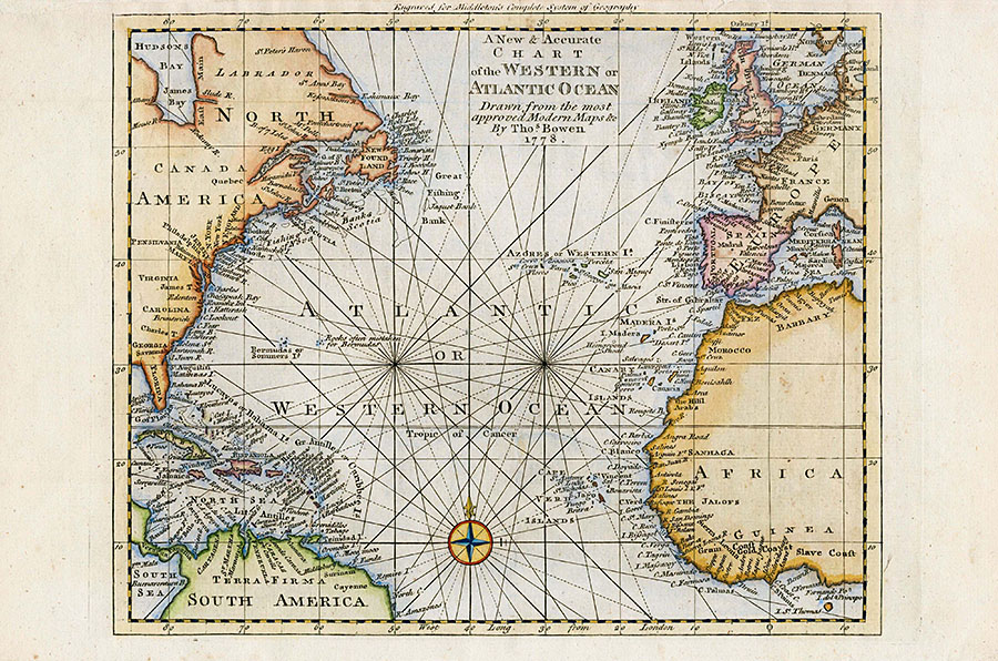
Chart of the Western Atlantic Ocean, North America, South America, Europe, Africa
by Thos Bowen1778 CSG1 $245 |
 |
|
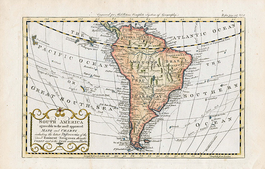
Map of South America, Amazon, Brazil, Peru, Paraguay 1778 CSG4 $225 |
 |
|
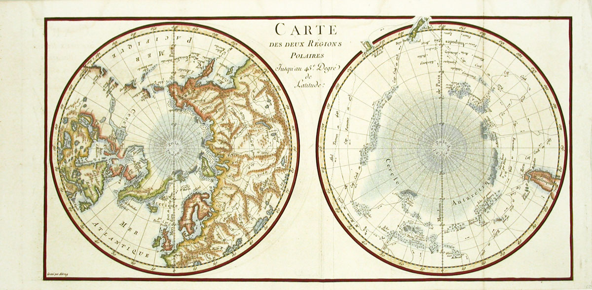
Map of the Two Polar Regions, Artic & Antartic
Buffon 1778 MTM1 $225 |
Please click on each image to enlarge and for prices
| Click to Contact |

Copyright © 2019 Panteek. All Rights Reserved. Privacy Policy